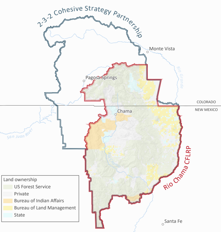
This landscape begins in the headwaters of the Chama, San Juan and Rio Grande rivers: the San Juan Mountains of southern Colorado. It covers 3.81 million acres of public and private lands, half of which are managed by the USFS as parts of the Carson, Santa Fe, Rio Grande and San Juan National Forests. The other half is managed by tribal nations, the States of Colorado and New Mexico, the Bureau of Land Management and private landowners. CFLRP dollars are distributed through the National Forests, but are required to be spent collaboratively. The designated collaborative group for this CFLRP is the 2-3-2 Cohesive Strategy Partnership.
Why here?
Forest conditions are inextricably linked to water quality and quantity downstream. The forests in Colorado’s San Juan Mountains provide much of the drinking water for New Mexico. In fact, the San Juan and Chama Rivers provide 75% of Albuquerque’s drinking water and 50% of Santa Fe’s drinking water. Today, the forests in the headwaters of those rivers are at high risk of severe wildfire, which would be catastrophic for the water resources of many communities downstream. The 2-3-2 and the Rio Chama CFLRP are one mechanism by which New Mexico and Colorado are working together to protect these water resources before a severe wildfire ignites.
THE RIO CHAMA CFLR IS A PROJECT OF THE 2-3-2 IN PARTNERSHIP WITH THE US FOREST SERVICE